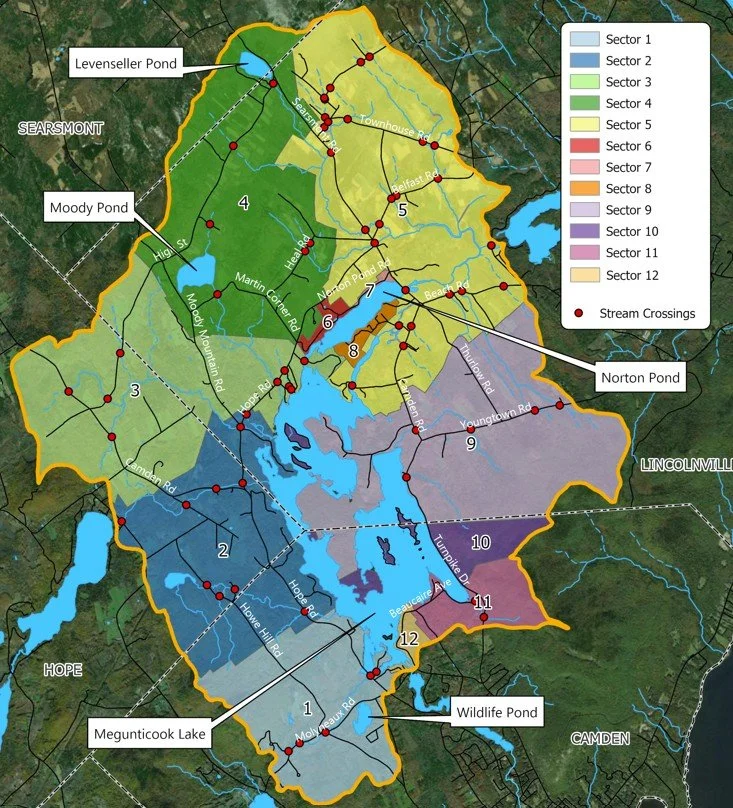
2026 Watershed Survey
The Megunticook Watershed Association has been funded to complete a full survey in May of 2026 of Megunticook Lake, Norton Pond, Levenseller Pond, Moody Pond, and select stream crossings. A survey of the Megunticook River will be carried out as a separate project in 2027.
What is a Watershed Survey
Watershed surveys are field surveys conducted by trained volunteers in the community to determine the extent of pollution in a particular watershed. Volunteers are trained to identify erosion problems because soil erosion is the largest source of phosphorus and sediment -- the major pollutants -- to lakes and ponds. Soil erosion is easy to identify and solutions are generally simple and inexpensive. This survey will focus on Lake Megunticook and Norton, Levenseller, and Moody Ponds, along with select stream crossings.
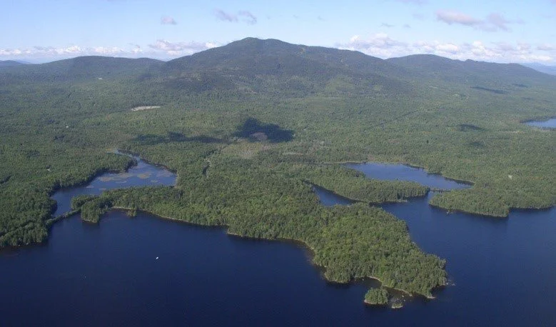
The watershed includes parts of the towns of Camden, Lincolnville, Hope, and Searsmont. The survey will help identify and prioritize sources of soil erosion and stormwater runoff on developed land in the watershed. Megunticook Lake is on the State of Maine’s Nonpoint Source Priority Watersheds List as “Threatened” due to its sensitivity to development in the watershed and because of its sediment chemistry which makes it more vulnerable to the release of sediment-bound phosphorus which can lead to internal loading. MWA has worked diligently over the years to protect the lake and ponds within the watershed since 1969 but the threats are ever-increasing. A current assessment of the watershed is needed to help develop a multi-year plan to protect water quality and inform future watershed management recommendations. A full watershed survey will assist in acquiring future state and federal funding to address sites of concern identified during the survey. This includes future cost-share grants for towns, road associations and landowners.
When and How Will the Survey Take Place?
Participation in the survey is voluntary, and property owners do not need to be present at the time of the survey. The watershed survey is scheduled to take place over two days, from Friday, May 1st through Saturday, May 2nd. Follow-up work may be needed through mid-May to visit all the developed land in the watershed. Once the fieldwork data has been collected, our partners at Ecological Instincts will produce a report that will be shared.
Each shorefront property (and some shorefront adjacent properties) will be surveyed as long as the property owner has not opted-out. An opt-out letter will be sent to all property owners in April. Information gathered during the survey will not require that a landowner make improvements and will not be used for enforcement purposes.
The quality of Lake Megunticook, Norton Pond, and all the ponds and streams in our watershed affects us all for recreational, social, and economic values. If we do not take immediate actions to prevent erosion and runoff from entering these water bodies, we risk facing long-term and possibly irreversible impacts to this resource.
Want to Help the Megunticook Watershed?
Volunteers are needed to participate in the watershed survey on May 1–2, 2026 to help identify areas where stormwater runoff may be affecting water quality in the Megunticook Lake watershed.
Survey teams consisting of a trained technical leader and 1-2 volunteers will walk assigned shoreline areas and drive roadside sectors looking for places where runoff is carrying soil, nutrients, or pollutants to the lake/ponds. No experience is necessary—training and survey materials will be provided.
This is a great opportunity to learn more about the watershed, spend time outdoors, meet your neighbors, and contribute to protecting one of the area’s most treasured natural resources.
We would love your help! No experience is necessary and training will be provided. If you’d like to join us, please reach out.